Ultimate Guide to Overlanding the Rubicon Trail
Published on May 18, 2021 - ↺ Last updated July 5, 2021

Overview: |
|
| Difficulty | Very Difficult |
|---|---|
| Length | 22 Miles |
| Elevation | 5,400 to 7,000 feet |
Meet the Rubicon Trail
If you are a fan of offroading and Overlanding, then let us introduce you to one of the toughest, but rewarding trails in the United States. The Rubicon Trail is a 22-mile route through the Sierra Nevadas in California. While the 22-mile course is shorter than most Overland routes, due to its difficulty it will still take experienced offroaders five to size hours to complete, but if you are traveling in a group or taking in the epic views, you’ll want to consider spending the night on the trail.
This of course is where Overlanding comes into play, and if you are properly prepared, you can stop alongside the trail and sleep for the night. The trail offers numerous spots to set up camp regroup and reflect on the day. Before you decide to make this trek you first must decide whether or not you are up for the challenge of the Rubicon Trail.
How difficult is the Rubicon?
Well speaking that it is one of the most difficult off-roading trails you can expect the trek to be very difficult. You will find that you will need a spotter frequently along your journey which also adds to the difficulty and length of your trip. Additionally, it is more difficult if you do not have any modifications for your vehicle like off-roading tires or higher suspension. Also what makes this trail difficult is that it is not a safe route by any means so with an inexperienced driver things can get dangerous fast. To add to that, there is little to no cell phone service during a large portion of the trail, so if you do get stuck or have an emergency it will be a while until you can get out for help.
Before you actually begin driving the trail you are also going to have to keep a solid eye on the conditions. Ideally try the trail on a perfect day without any rain or other weather, doing the trail when it is wet will only make it more difficult. The difficulty also increases with the number of people on the trail since it is very popular, but if someone gets stuck then everyone else behind them has to wait. If you don’t already get the point, the Rubicon Trail is very difficult.
How to Prep Your Vehicle For the Trail
Preparing your vehicle for the Rubicon Trail will share many similarities to trail rights, but the level of difficulty requires additional preparation based upon your vehicle and set up.
Rubicon Vehicle Preparation Checklist:
- Check and Top Off Fluids (Oil, Coolant, Steering, Brakes, Wiper, etc)
- Check Brake Fluid and Pads
- Check Accessory / Fan Belts
- Check & Tighten Suspension Bolts
- Check & Tighten Wheel Lugs
- Verify Communication Devices are Working
- Verify Emergency Kit is in Order
- Verify First Aid Kit is in Order
- Valid Drivers License and Vehicle Insurance
Rubicon Trail Upgrade Recommendations
Upgraded parts are not required but highly recommended for the Rubicon. Due to the difficulty of the trail, high clearance spots, and slick surfaces, modified rigs will have an easier time traversing the Rubicon Trail. The following upgrades are recommended for the trail, but ultikately it comes down to preparation.
- Suspension Lift
- 33″ or Larger Tires
- Front or Rear Lockers
- Winch, Traction Boards or Recovery Straps
- High Lift Jack
Once you are at the start of the trail, it’s time to air down your tires, engage four-wheel drive, and start the Rubicon.
Where to Camp Along the Rubicon Trail

Wentworth Springs near Pollock Pines, CA
US Forest Service | Developed CampgroundLocation: 39.0121285, -120.3254717
Cost: No fee, No services.
View Details
Near Walker Hill
US Forest Service | PrimitiveLocation: 39.022132027, -120.290743552
Winter Camp
US Forest Service | Dispersed CampingLocation: 39.021464000, -120.277468000
Buck Island Lake
US Forest Service | Dispersed CampingLocation: 39.002628517, -120.252596692
Rubicon Springs
Private Campground | ManagedLocation: 39.017933000, -120.246557000
Cost: $10 Day Use, $20 Overnight
View DetailsTop of Cadillac Hill near Observation Point
Tahoe National Forest (TNF) | Dispersed CampingLocation: 39.0121285, -120.3254717

Camp Chiquita Campground near City:Georgetown
Camp Chiquita Campground & RV Park | Dispersed CampingLocation: 38.93836302, -120.73972288
Cost: $30 Daily
View DetailsWhere Does the Rubicon Trail Start and End?
There are two direction
Again the Rubicon Trail is located in Northern California near Lake Tahoe. To be more specific the beginning of the trail is just off Highway 50 near Loon Lake and the route ends on the west side of Lake Tahoe at Tahoma. You have to follow this standard route or you will be running into lots of traffic on the trail. There is no spot for you to pull off, so you have no option but to follow this standard route.
The Rubicon Trail ends at the McKinney/Rubicon Trailhead, near Mckinney Lake. From here you can follow the signs down to Lake Tahoe.
Trail Videos
There are a lot of great videos of others tackling the Rubicon Trail. These can help you prepare and understand what to expect on the trail.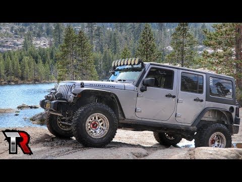


Frequently Asked Questions:
How difficult is the Ruicon Trail?
The Rubicon Trail is one of the more difficult trails within the United States. The rocky and sometimes slick terrain requires a good ground clearance, great tire placement and good tire grip to successfully traverse the trail. With multiple difficult obstacles, the Rubicon Trail gets a ‘VERY DIFFICULT’ rating.
Can a Jeep Wrangler Rubicon run the Rubicon Trail?
When the Jeep Wrangler Rubicon was first introduced in 2007, it was designed to be able to complete the trail in factory trim.
This trim level included Dana 44 axels, electric locks, a 4:1 transfer case, rock rails, sway bar disconnect, and an 8.8 in ring gear.
How did the Rubicon get it's name?
The Rubicon Trail is of course named after the nearby Rubicon River. This river was named after the Rubicon river in Rome, which was crossed by Julius Ceasar, before becoming Emperor.